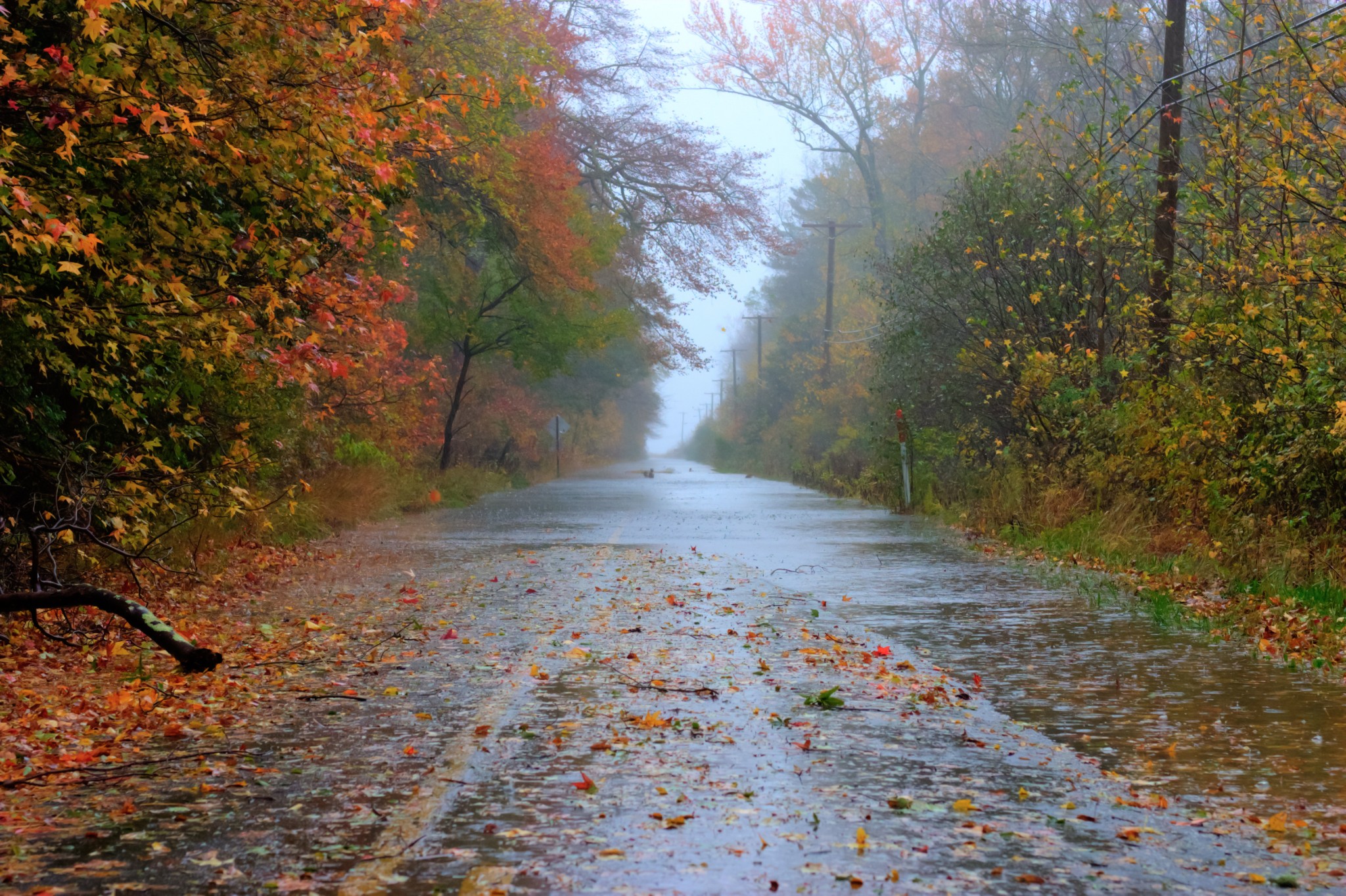
A rain-slicked road lined by red, orange and green autumn trees fades into mist.

The Sandy Threshold

OCTOBER 22, 2012

“Wow, if the overnight Euro (00Z ECMWF – hour 192) verifies, then New Jersey will have a serious problem next Monday-Wednesday.”
“NOTE: This is not a forecast.”

Jonathan Carr · Severe NJ Weather (later WeatherNJ) · October 22, 2012 · Two excerpts from the same post.

A note on the Euro: The “Euro” is the commonly used nickname for the global weather forecasting model produced by the European Centre for Medium-Range Weather Forecasts (ECMWF). Its Integrated Forecasting System (IFS) uses atmospheric observations and mathematical models to predict how weather may develop days into the future. In Jon’s post, “00Z” identifies the midnight UTC model cycle, while “hour 192” refers to a prediction eight days into that forecast.

Before Sandy Arrives

Maryland | Friday, October 26–Saturday, October 27, 2012

I spent the weekend before Hurricane Sandy in the Baltimore suburbs, making one of my routine weekend jaunts to visit friends Jonathan and Jennifer Carr.

Jon proved as dialed in as the Euro, consistently sniffing out a storm that would be different. All week we talked forecasts, tracking each new model run. The Euro’s dogged consistency raised the temperature, run after run after run.

On Saturday, October 27, we went to Annapolis, Maryland, hoping to break up the tension and nervous energy. It was a new destination for all of us save a young Jon. We walked around, ate, explored, and stopped street-side in awe of a gallery featuring large, handmade wooden topographical maps. Fresh-faced midshipmen milled about the square. Their posture as precise as their hem.

A spot of normalcy in a place that felt like Princeton by the Sea. Linen sails, brownstone buildings. Old America backdropped by ominous clouds offshore, contrasted starkly by a litany of white sails. Yet there was no escaping our pending reality.
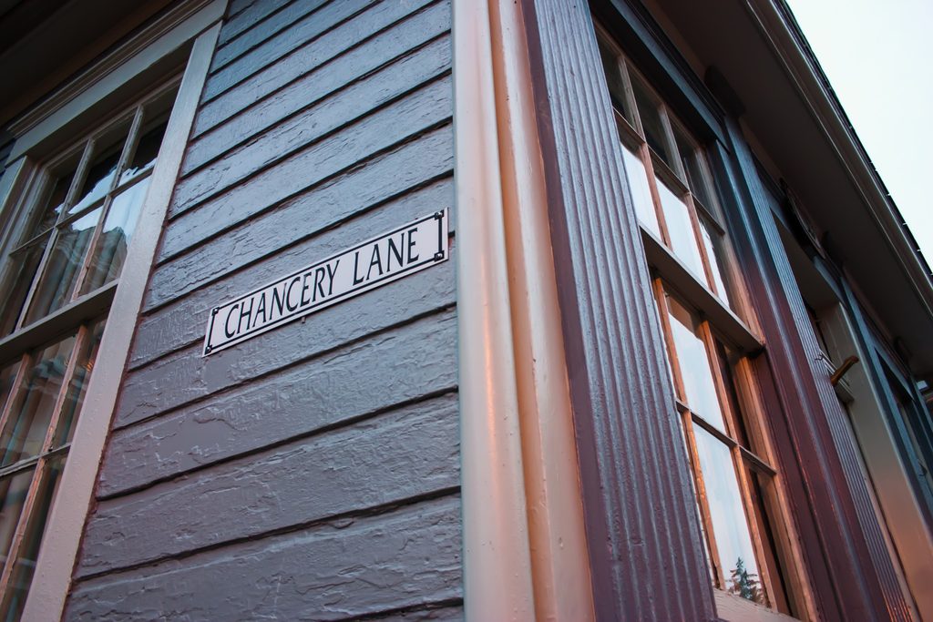
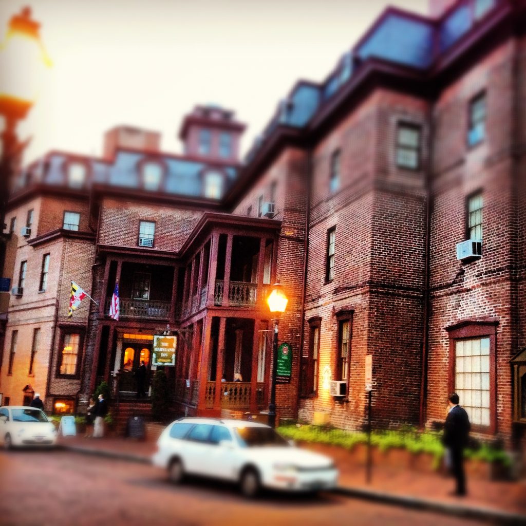
A Chancery Lane street sign and architectural details in Annapolis, Maryland.
Street sign marking Chancery Lane in Annapolis, Maryland, photographed Saturday, October 27, 2012, during a weekend visit with Jonathan and Jennifer Carr shortly before Hurricane Sandy. Greg Molyneux’s Photo366 Day 301 selection.
Annapolis street scene with brick buildings, cars and people under glowing streetlights.
Annapolis street scene from Saturday, October 27, 2012, during my visit with Jonathan and Jennifer Carr.

Driving back toward Baltimore from Annapolis, tabs were kept.
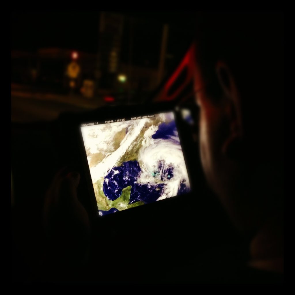
An iPad displaying NOAA GOES-13 satellite imagery is held inside a vehicle at night.
Jonathan Carr observing Sandy on his iPad during the drive back from Annapolis, Maryland, Saturday, October 27, 2012, approximately 9:00 p.m. The display shows NOAA GOES-13 satellite imagery. @gregmolyneux’s contemporary Instagram caption records that the group was continuing to follow the approaching storm.

“Driving home from Annapolis and we’ve got Sandy queued up on the iPad. #sandylooms.”

Hello New Jersey | Sunday, October 28, 2012

On Sunday, October 28, I drove home to New Jersey. Here you can read Jon’s forecast that day.
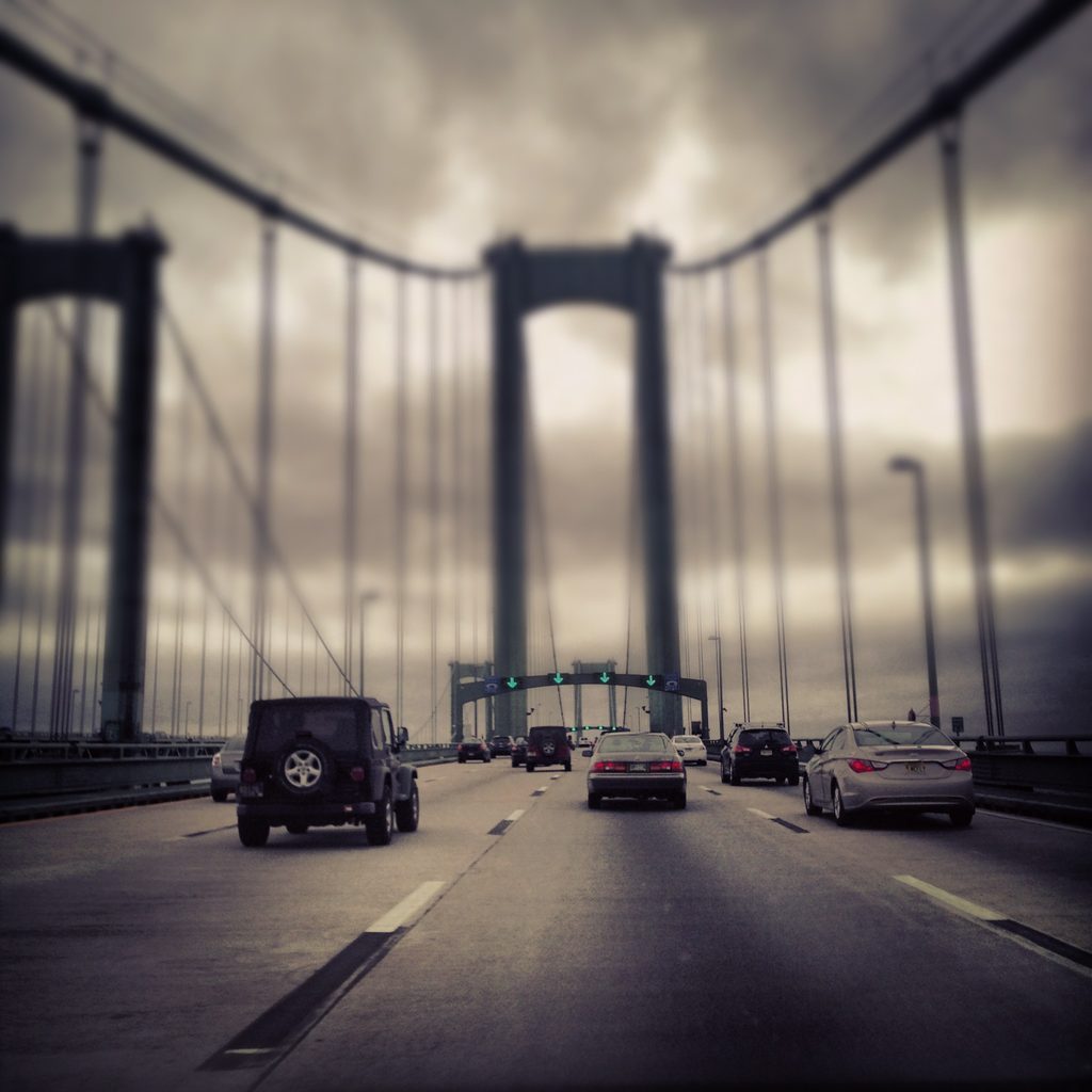
Roadway and bridge structure on the northbound Delaware Memorial Bridge, crossing the Delaware River toward New Jersey.
Hello New Jersey from @gregmolyneux Instagram. Northbound on the Delaware Memorial Bridge, returning to New Jersey on October 28, 2012, as Sandy approached.
A single fallen red-orange autumn leaf on the ground.
Lady Autumn, Give Us All Your Color. A fallen autumn leaf photographed in southern New Jersey on October 28, 2012, before Sandy arrived. Photo366 Day 302.

In Sandy’s Grip

Sandy’s Onset | Sunday, October 28, 2012

Later that night I took a short drive. As I stood at the edge of East Bay Avenue, just west of the Causeway bridge in the Mud City section of Manahawkin, already everything felt off. The surge was coming, and we were only throwing out the first pitch. Find my captured video footage below.

Monday, October 29, 2012

Monday morning, I grabbed my camera and made my way about town. I wanted to see how far east I could push.
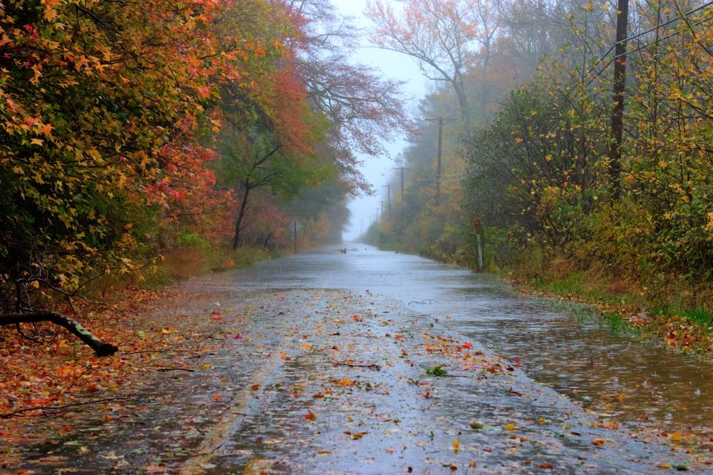
A rain-slicked road lined by red, orange and green autumn trees fades into mist.
Beauty in the Midst of Chaos. Hilliard Boulevard, looking east in Manahawkin, October 29, 2012. Rain-soaked road beneath autumn trees as Sandy approached landfall. Photo366 Day 303.

That same day, I went out with Joe and Jackie Bilotta to see the storm. Joe was driving his 4Runner. Jackie sat up front, eager yet concerned; I rode in the back astride the bench seat.

Crack! A tree started coming down. Joe hammered the brakes. It landed just ahead of the vehicle. Shellshocked and chastened, we turned around.

Later that afternoon, I filmed the wind whipping through the trees near my parents’ home in Ocean Acres.

That evening I returned to Cedar Run Dock Road. I had photographed the marsh there many times. This was during a period of decreased winds if you can believe it, but the water remained high.

Crossing the Threshold

Tuesday, October 30, 2012

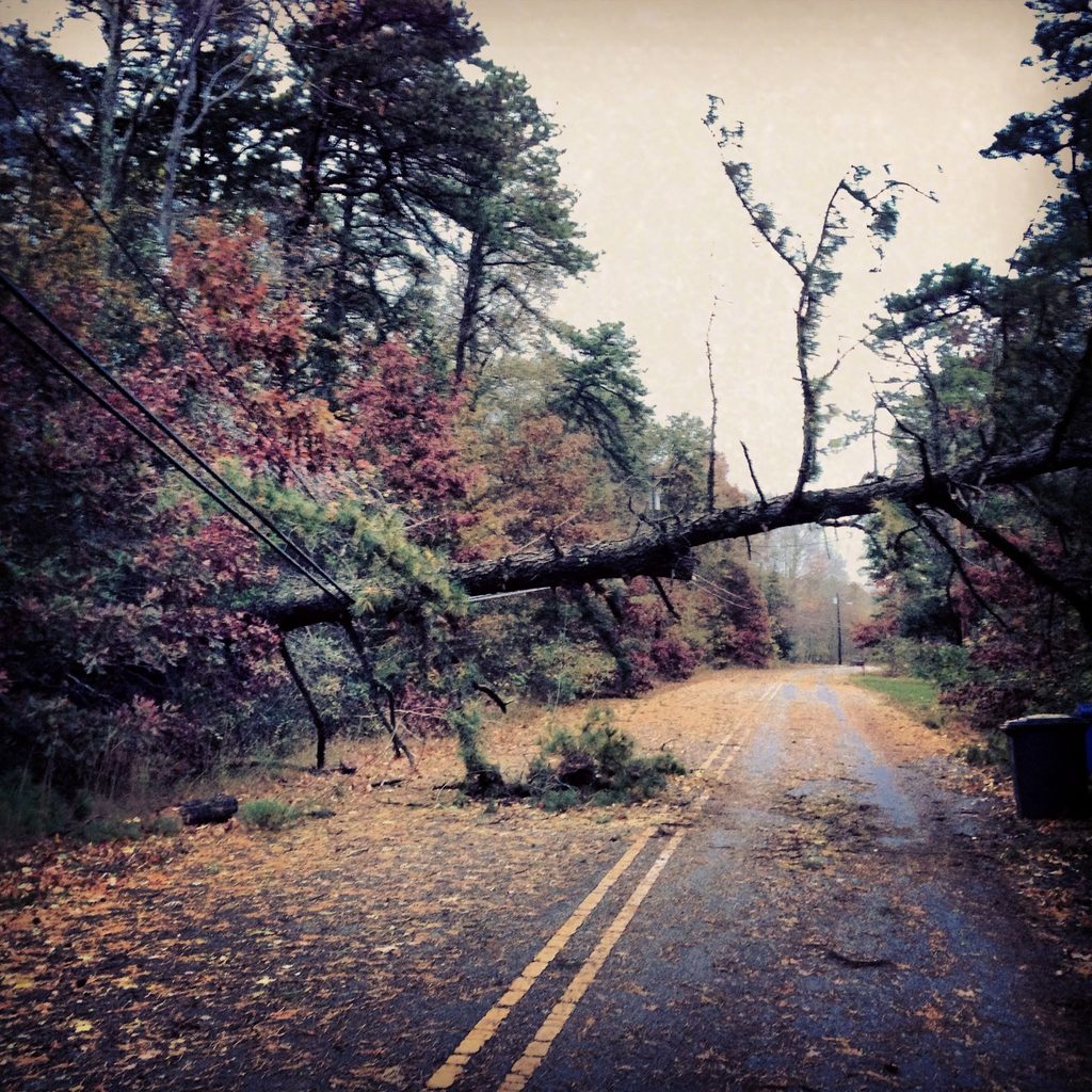
On Tuesday, I shared a photograph of the tree and telephone pole from the previous day’s close call.
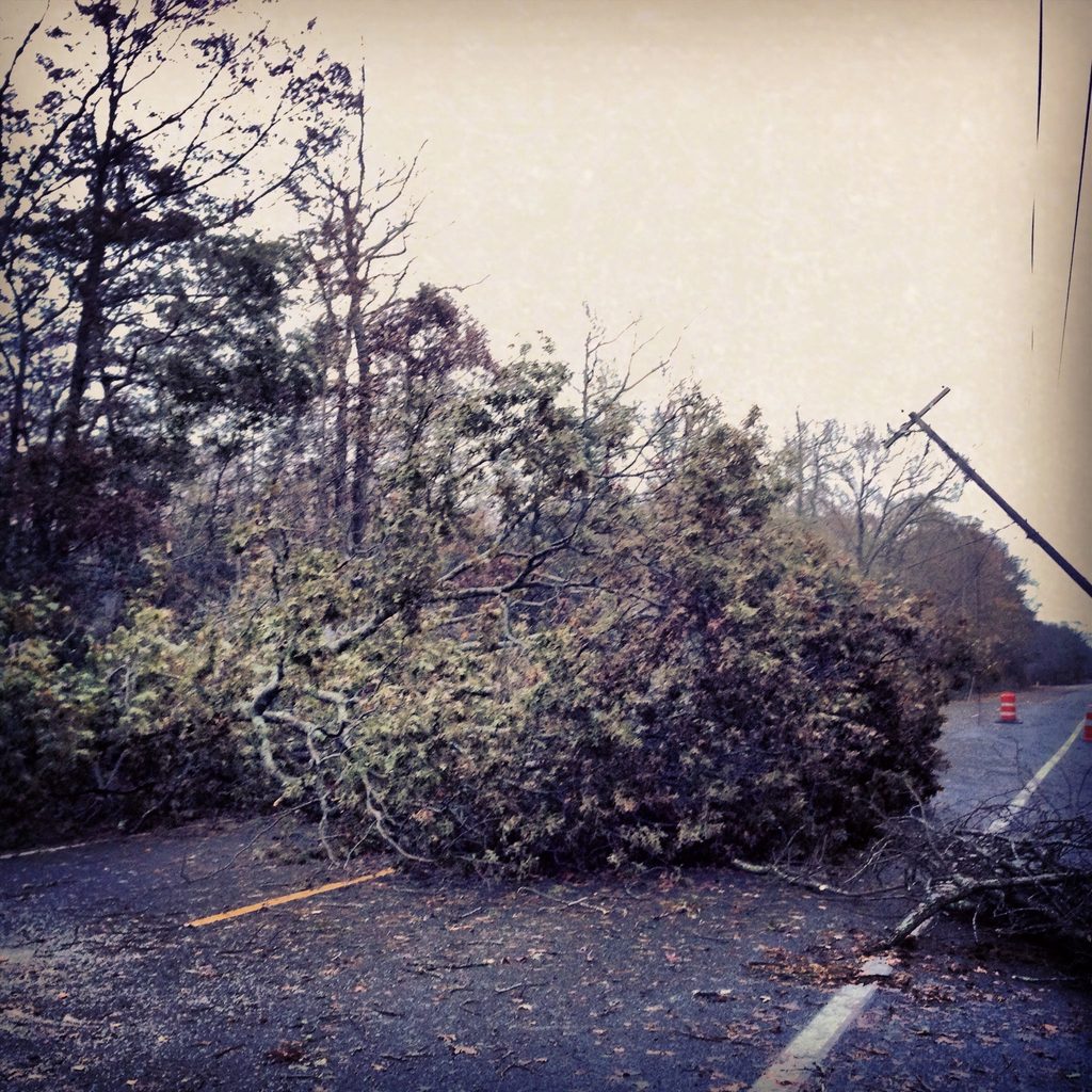
A fallen tree blocks a wet roadway beside a leaning utility pole; orange traffic barrels stand beyond the obstruction.
Fallen tree and leaning utility pole on Hilliard Boulevard, looking east in Manahawkin, following the October 29 near miss. Shared October 30, 2012. The photograph documents the aftermath, not the moment the tree fell.

“The tree and telephone pole that almost crushed my friends and I yesterday.”

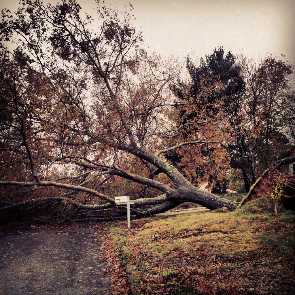
Elsewhere, hell, pretty much everywhere, the scene was the same. Fallen trees, blocked roads, damaged homes and property.
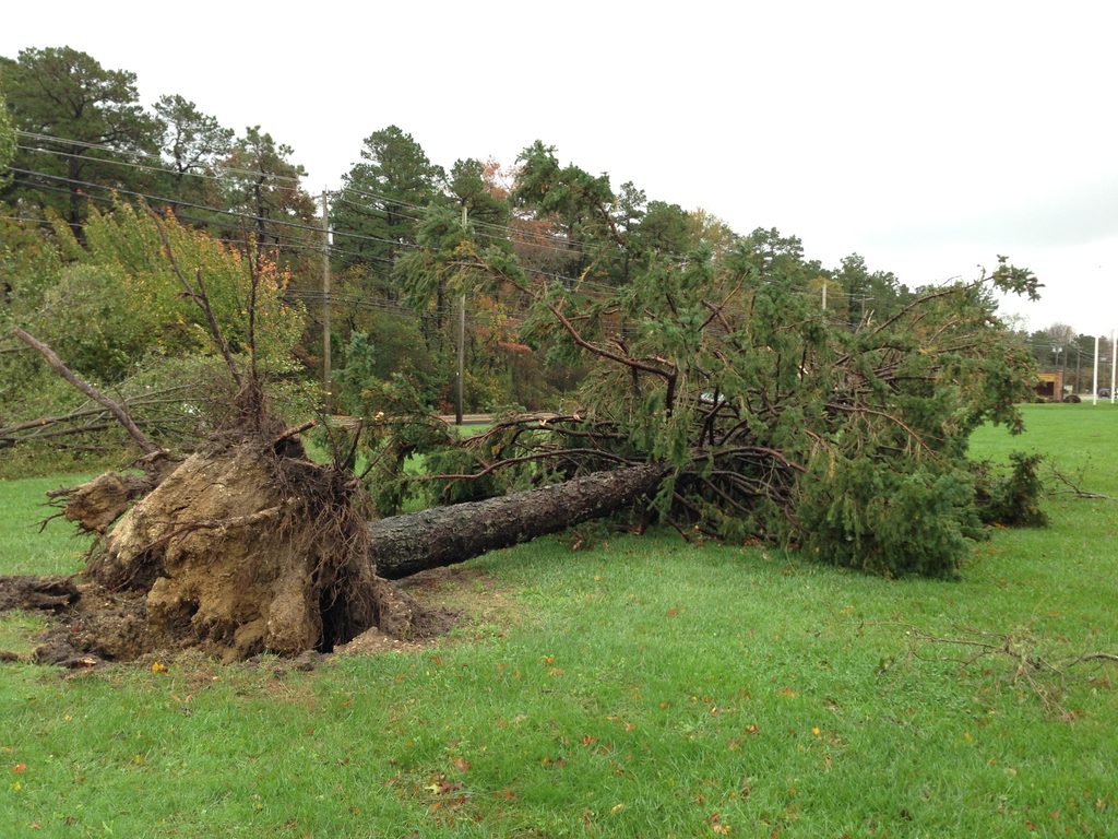
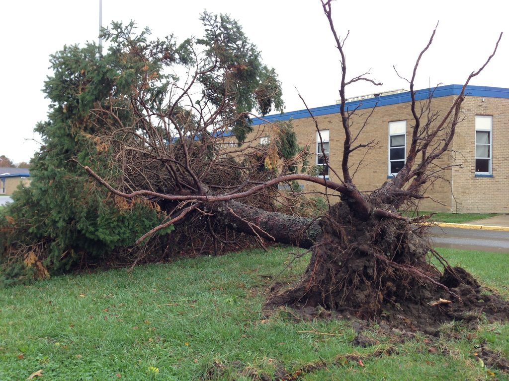
Two houses down from my parents’ home, a tree had struck a neighbor’s house.
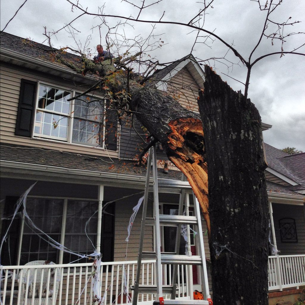
A tree trunk lies against the side of a house, with a ladder and a person near the roof.
“We’ve got to get this tree off my parents’ neighbors house.” A neighbor’s home in Ocean Acres, Stafford Township, as the tree was being cleared on October 30, 2012.
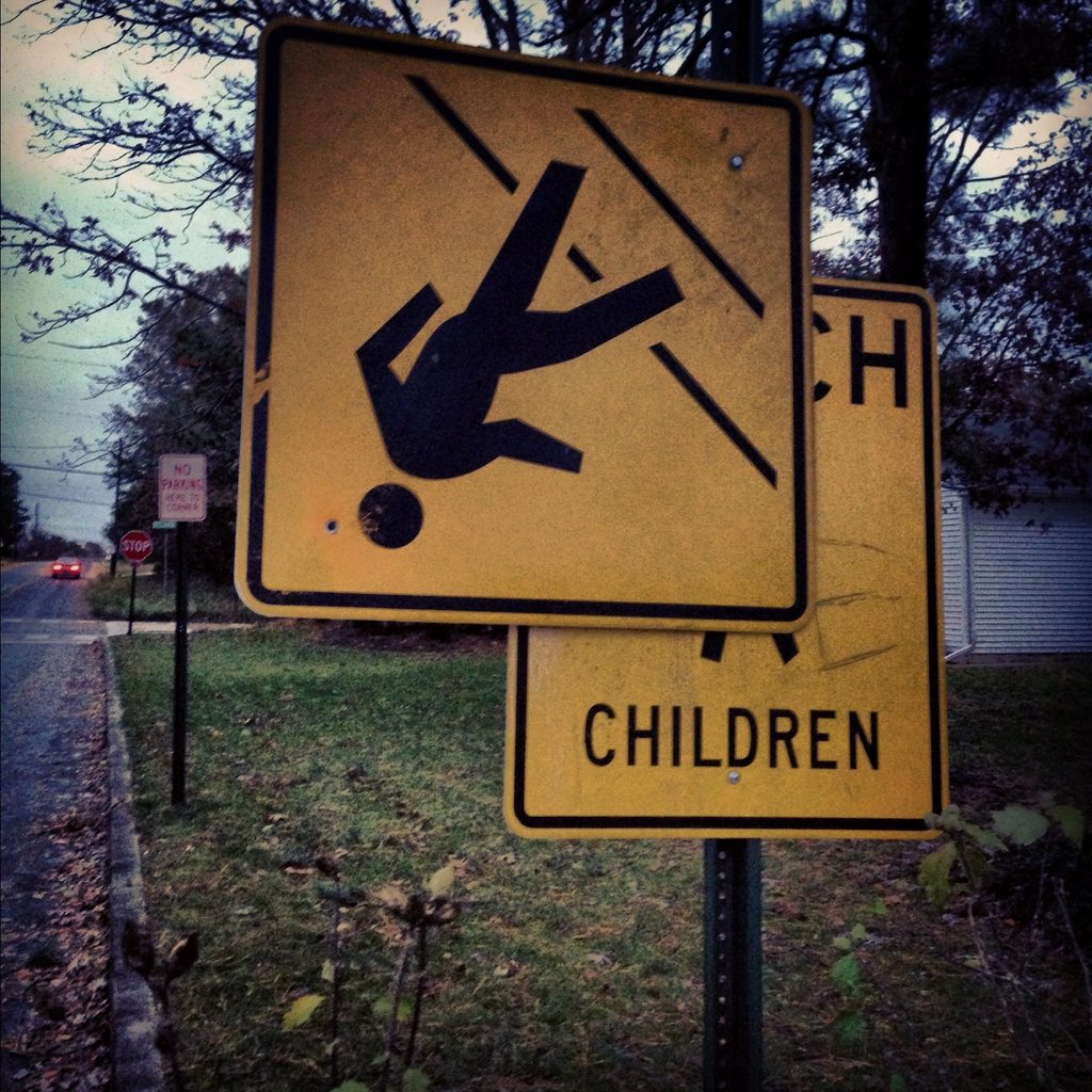
A yellow school-crossing road sign appears upside down beside a street.
“Watch out for folks walking on their heads.” An upside-down school-crossing sign in the Manahawkin area, shared on Instagram October 30, 2012.

I went back to Cedar Run Dock Road. Water had carried boats, docks, and debris into places I never expected to find them.
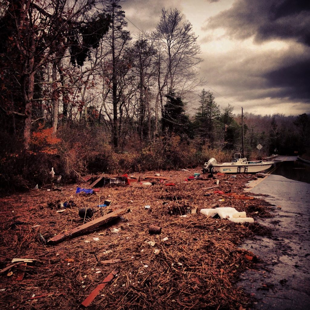
Storm debris, marsh grasses and scattered material stretch across Cedar Run Dock Road.
“The power of water. This is just the beginning of what I’m seeing.” Storm debris along Cedar Run Dock Road in Stafford Township, shared October 30, 2012.
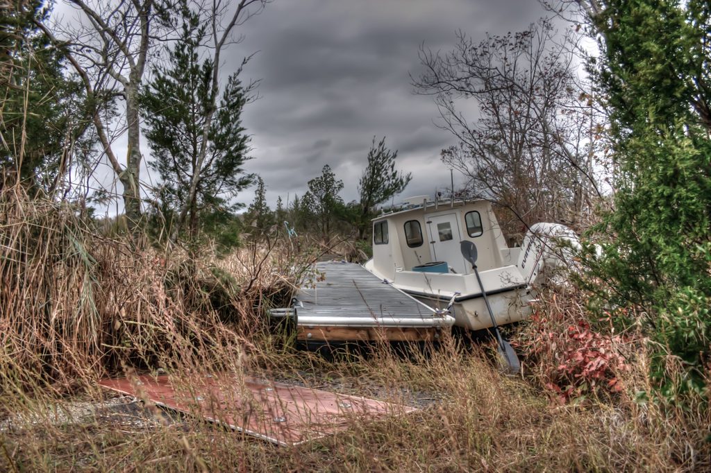
A small boat and the floating dock to which it is tied rest on dry ground.
That’s Quite a Knot. Still tied together, a small boat and its floating dock came to rest on land in the southern New Jersey back bays after Sandy. October 30, 2012. Photo366 Day 304.
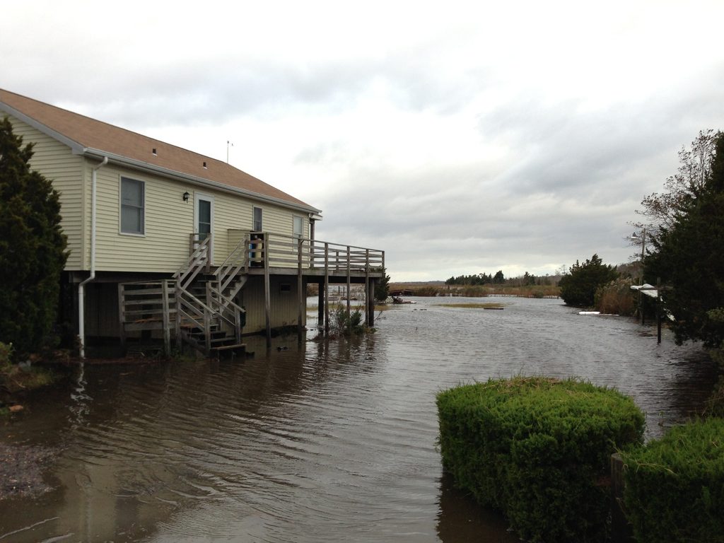
A raised house surrounded by water in a southern New Jersey back-bay landscape.
Water surrounds a raised house and extends across the adjoining ground in the southern New Jersey back bays during the Hurricane Sandy period.

Wednesday, October 31, 2012

On Wednesday, October 31, I went out again. Around familiar roads and marshes, I found things where they did not belong.
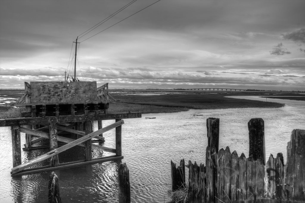
A weathered bridge structure beside water and marsh vegetation under an overcast sky.
Unknowing. The Bridge to Nowhere in southern New Jersey, October 31, 2012. Photo366 Day 305.

Archival note: The bridge’s weathered condition predates Sandy and was not caused by the storm. I know where I made this photograph and when thanks to good filenames and contemporaneous useful metadata. Until I began this project, I had no memory of even visiting the Bridge to Nowhere during Sandy or its aftermath.

Near the area of Mud City where I recorded Sandy’s onset Sunday night, I found blue barrels and battered billboards.
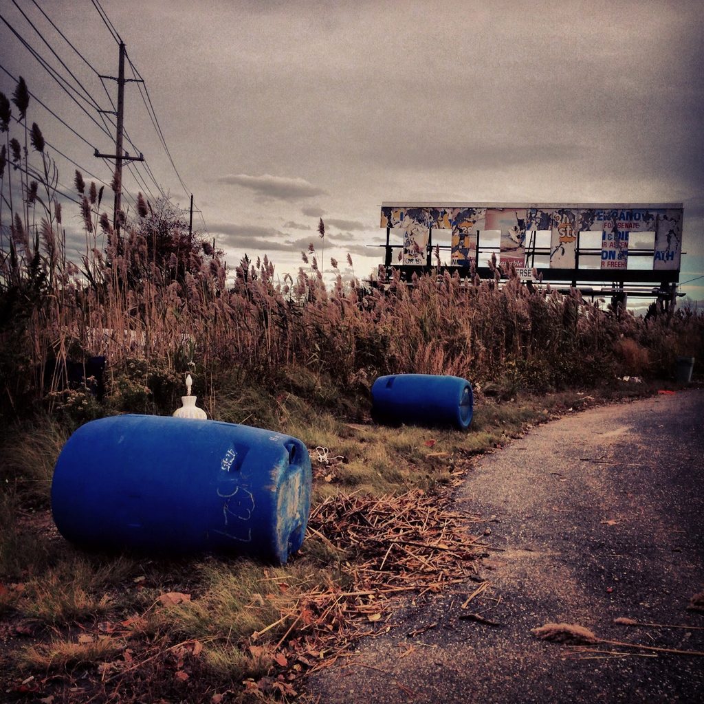
Blue barrels lie beside a dirt path while weathered billboards stand beyond tall marsh grasses.
“Battered billboards.” Blue barrels and weathered billboards near Mud City, Manahawkin, in the aftermath of Sandy. Shared October 31, 2012, near the area of the earlier storm-onset footage.
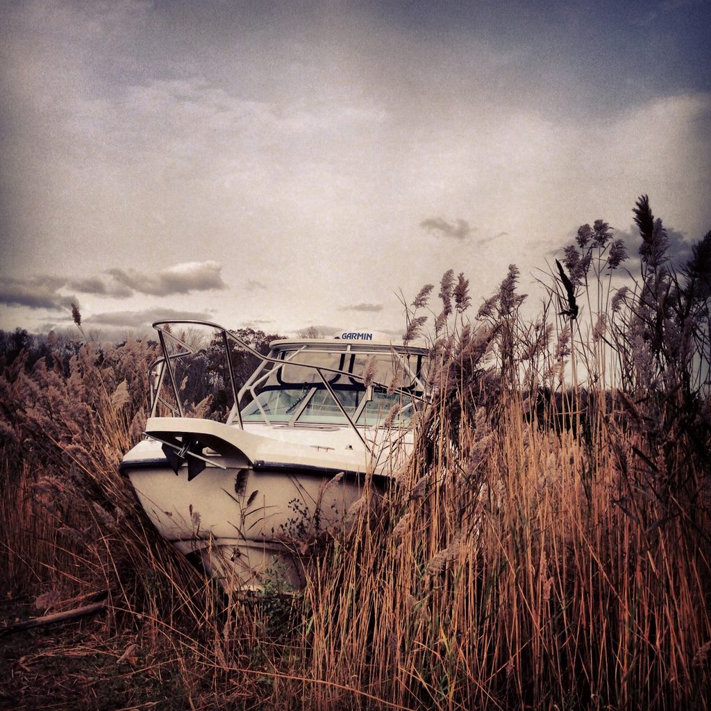
A white motorboat rests among tall marsh reeds beneath a cloudy sky.
“Keep finding boats on all the wrong places.” A white motorboat rests in the marsh reeds of the Manahawkin back bays, October 31, 2012.
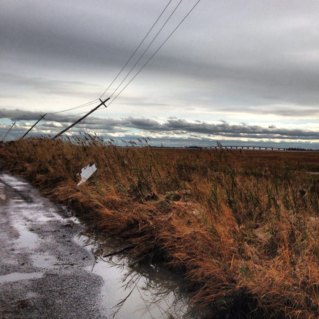
A leaning utility pole and wires stand beside a bridge and marshy water under a gray sky.
“Poles askew; the bridge lives!” A leaning utility pole beside a bridge in the Manahawkin back bays, October 31, 2012.

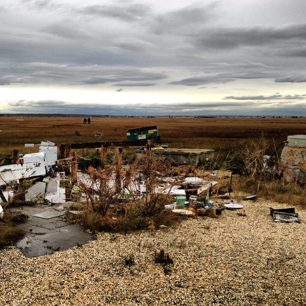
I returned to Cedar Run Dock Road one more time. Just west of the boat ramp, tucked in on the north side of the marsh, I photographed a site where a house had stood. Some buildings still remained; few were ever the same.
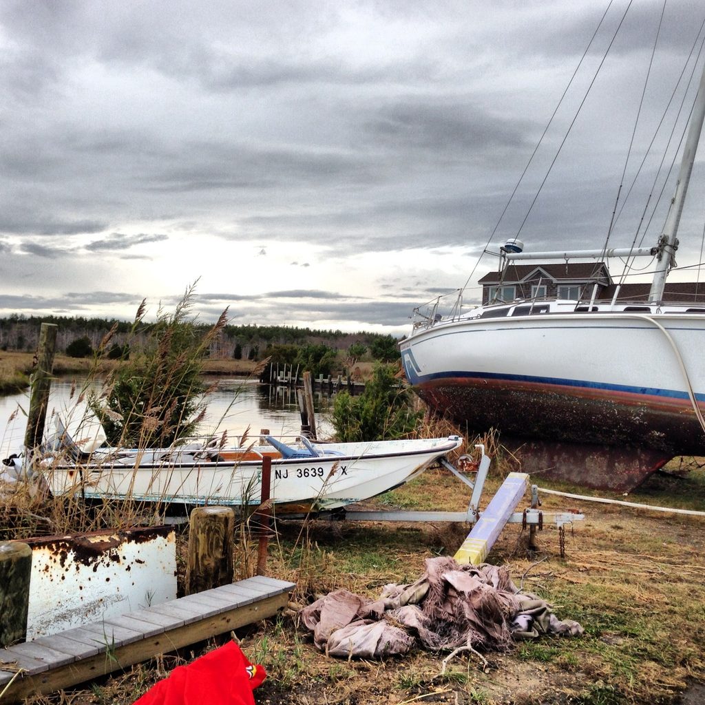
A large sailboat and a smaller boat sit ashore beside damaged docks and marsh grass.
“Not supposed to be here.” Sailboats stranded ashore near Cedar Run Dock Road, Stafford Township, in the aftermath of Sandy. Shared on Instagram October 31, 2012.
Broken building debris lies in a cleared patch beside marsh grasses under an overcast sky.
“There was a house here.” The remains of a house on the north side of the marsh, just west of the Cedar Run Dock Road boat ramp, October 31, 2012.
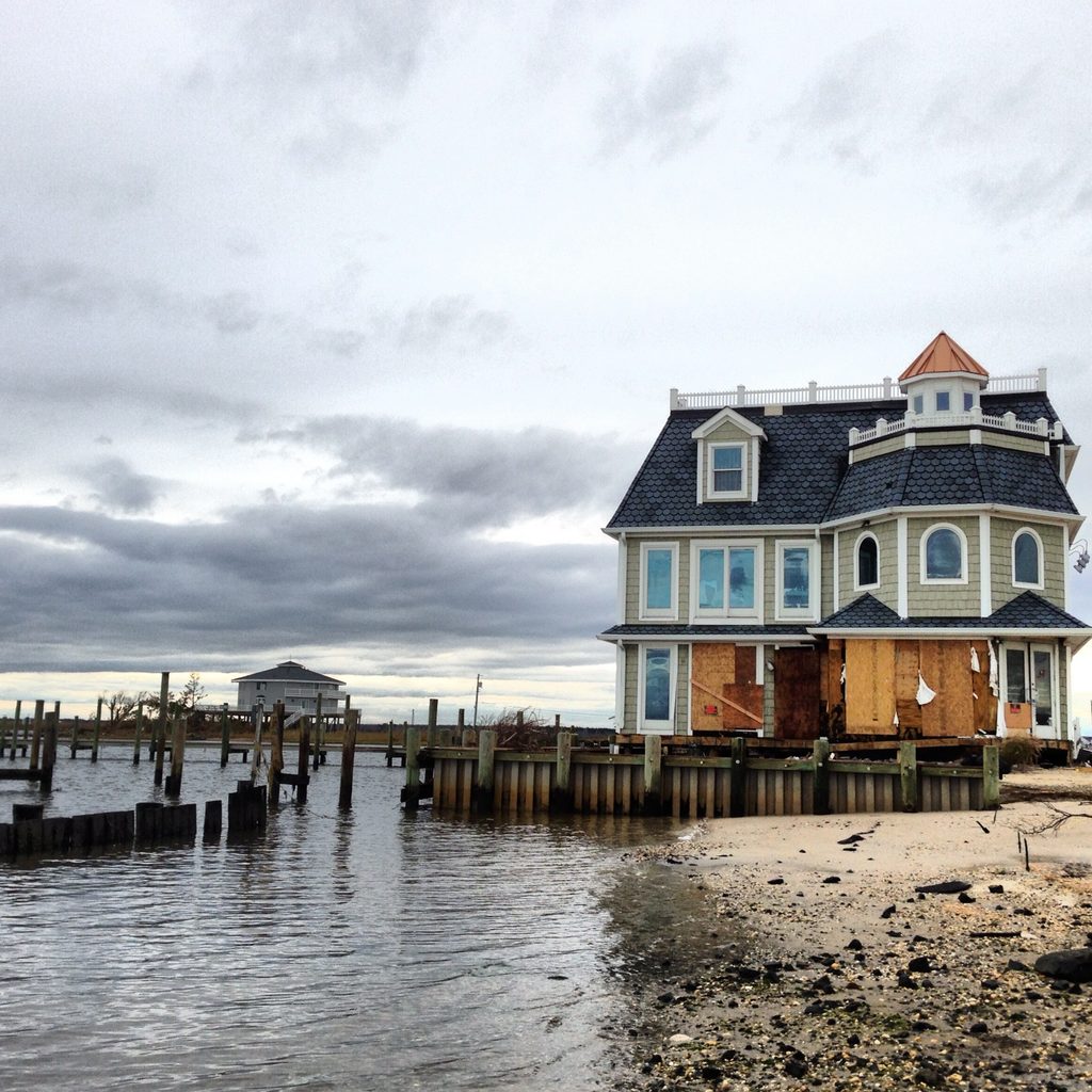
A multistory house beside a water-covered shoreline under heavy gray clouds.
“Holding strong.” A waterside restaurant still standing at the east end of the Cedar Run Dock Road area of Stafford Township after Sandy, photographed October 31, 2012.
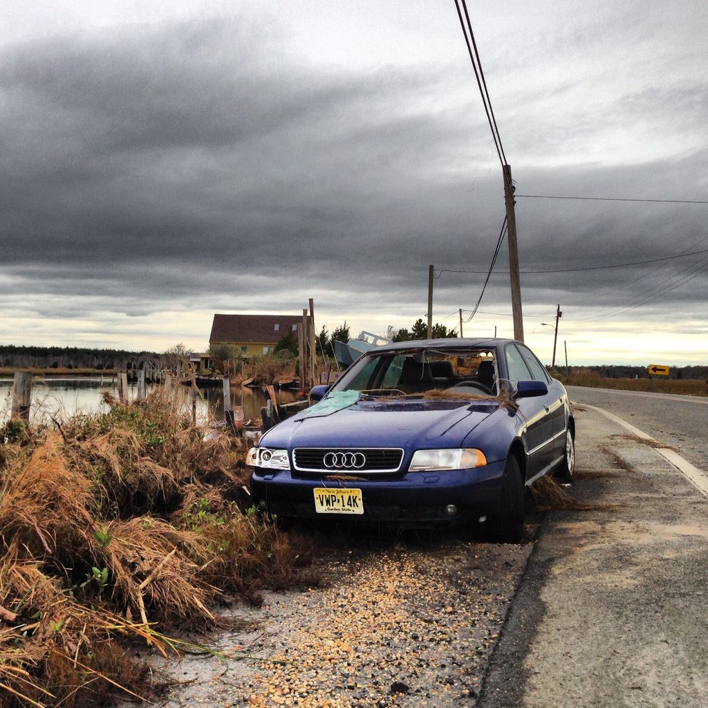
A blue Audi stands beside a visibly bent utility pole at the edge of a road.
“Smashed.” A blue Audi beside a sharply bent utility pole on the eastbound side of Cedar Run Dock Road, shared October 31, 2012.

What Remains

The days afterward | November 1–3, 2012

I kept photographing. Not every frame showed damage. On Thursday, November 1, I photographed Ballanger Creek. Still water reflected the trees and clouds.
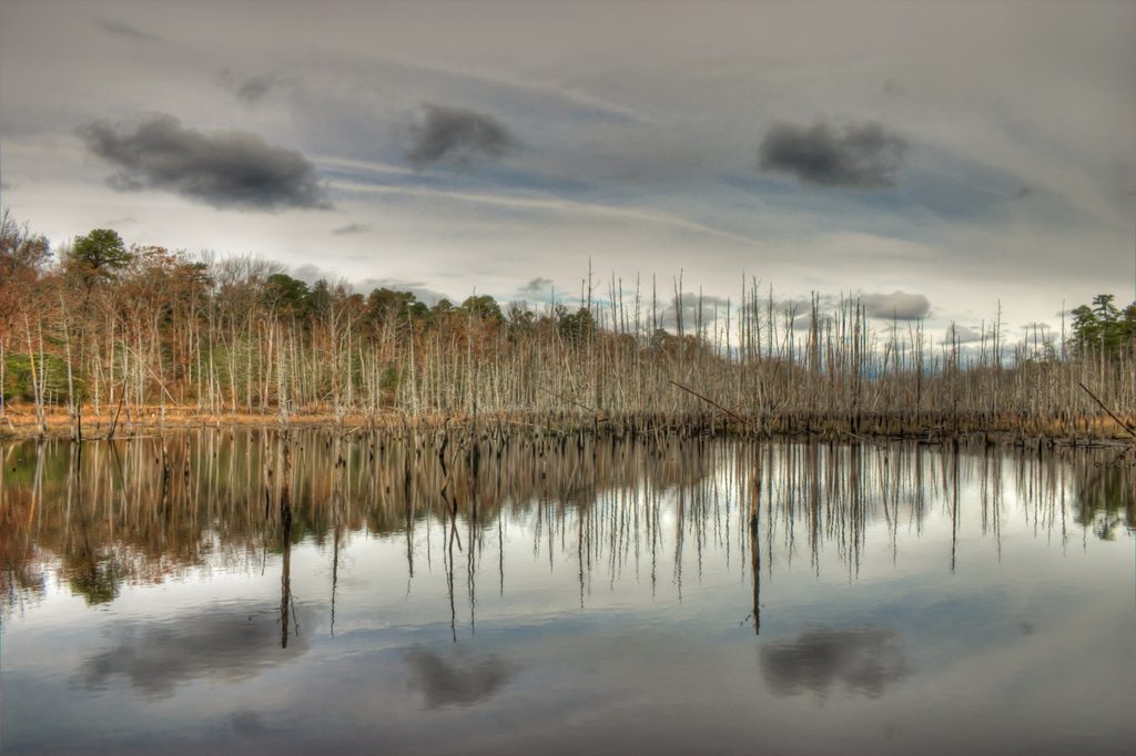
A quiet creek reflects bare trees and pale clouds.
Mirrored at Ballanger Creek. Still water reflects trees and pale clouds on November 1, 2012, in the days following Sandy. Photo366 Day 306.

I made my best effort to get to as many local marsh spots as possible. At Mott’s Creek, I photographed a sign, mailboxes, and the roadside.
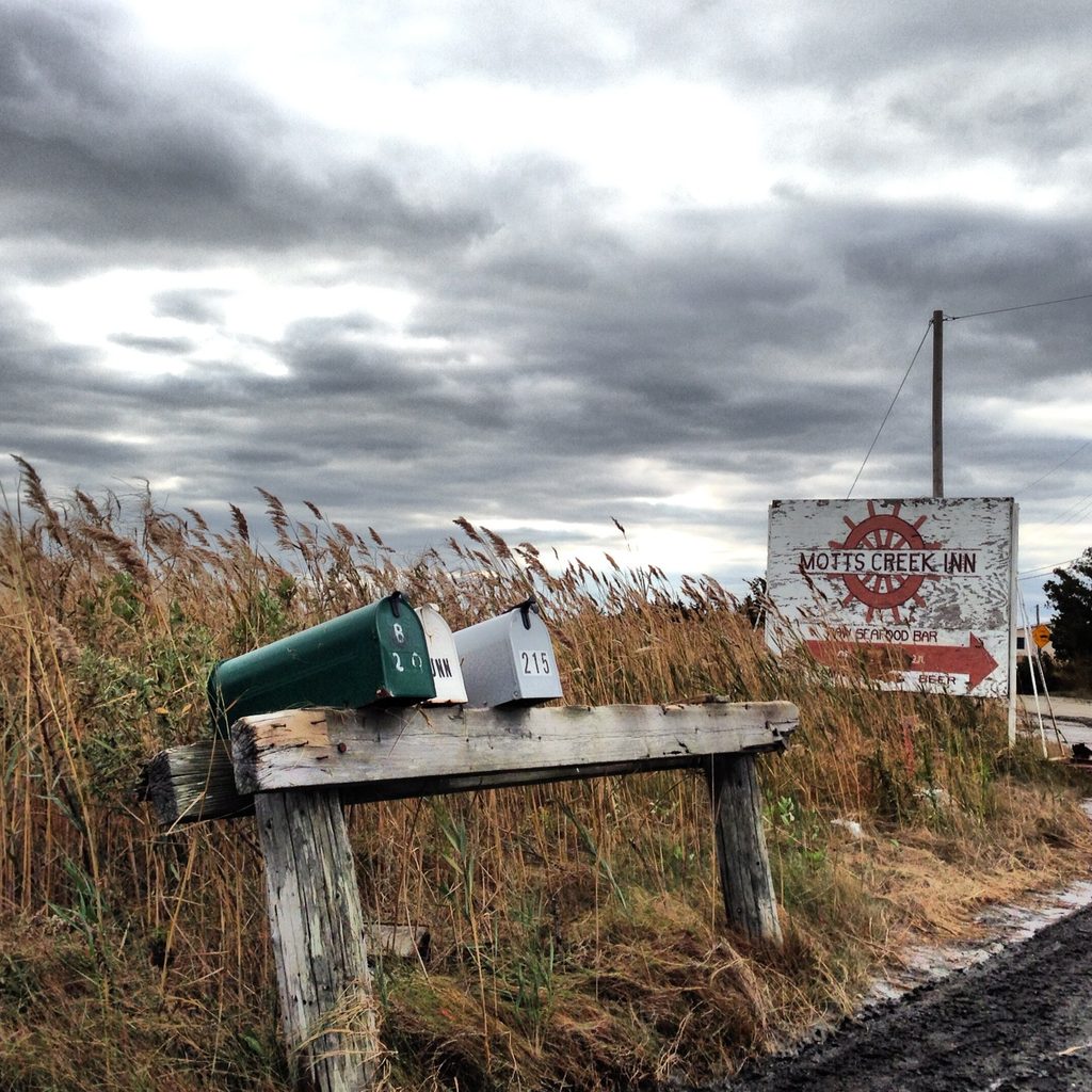
A weathered Mott's Creek Inn sign and mailboxes stand beside a narrow marsh road.
“Where have all the mailboxes gone?” Roadside mailboxes and the Mott’s Creek Inn sign at Mott’s Creek, Atlantic County, November 3, 2012.

Thursday, November 8, 2012

And then snow fell.
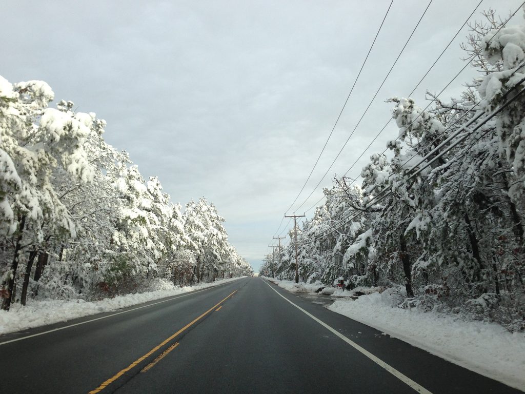
A two-lane road extends through trees coated in early-season snow.
“And then snow fell.” An unusually early snowfall along Route 539 in southern New Jersey, November 8, 2012, ten days after Sandy’s landfall.

When I shared an album of Sandy photographs on Saturday, November 3, 2012, I still hadn’t been over to the beach. Long Beach Island was closed indefinitely to non-residents and non-essential emergency personnel. It would be weeks before I got over there. My contemporaneous pictures show only a small part of Hurricane Sandy’s aftermath, though it matters to me that I share here my best recollection of this historic event. The Sandy threshold left us forever changed, and this is my small story.